Deep pools are persistent habitats within river systems that provide vital refuges for fish and other aquatic organisms, particularly during periods of reduced water flow and seasonal drying. By retaining water for longer periods than surrounding river stretches, these habitats provide stable conditions for feeding, breeding, shelter and survival, and can support a higher diversity of aquatic life. Their ecological importance makes the identification and monitoring of persistent pools essential for biodiversity conservation and river management. GIS integrated with remote sensing provides an effective approach for identifying and mapping these habitats over large river landscapes..
In this study, we used Sentinel-2 imagery (2016-2021), to map the water-spread dynamics across five ecologically distinct reaches of the mid Godavari Basin (Wainganga, Wardha, Pranhita, Godavari-mid and Manair) at multiple temporal scales. This analysis enabled the identification of persistent deep pools by quantifying perennial water presence within the floodplain.
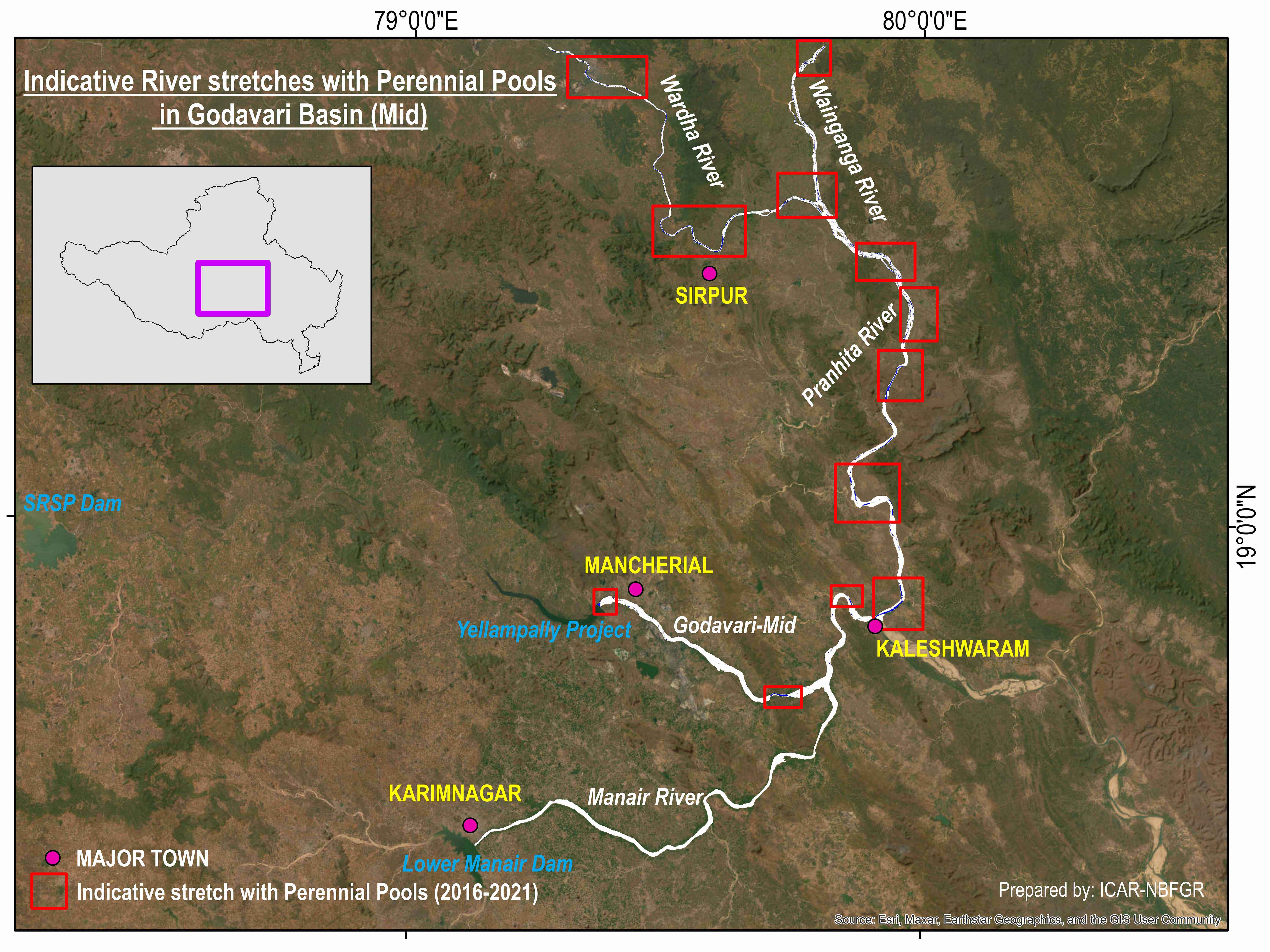
Indicative River stretches with deep pools in Godavari Basin (Mid)
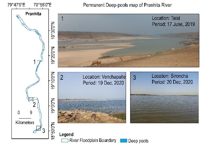
Map showing the demarcated permanent deep pools (2016-2021) and field validations along the river Pranhita in Godavari basin
Detailed methodology and results can be found : Kantharajan, G., Anand, A., Krishnan, P., Singh, R.K., Kumar, K., Kumar Yadav, A., Mohindra, V., Shukla, S.P. and Lal, K.K., 2022. Applications of Sentinel-2 satellite data for spatio-temporal mapping of deep pools for monitoring the riverine connectivity and assessment of ecological dynamics: a case from Godavari, a tropical river in India (2016–2021). Environmental Monitoring and Assessment, 194(8), p.558.
https://doi.org/10.1007/s10661-022-10089-6